
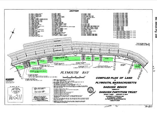
Lots owned by the Saquish Beach Land Trust are highlighted in green on the map. Property lines extend from the centerline of the Boulevard south east to the mean low water line. The links to the lots are viewable on the Town of Plymouth Website (click the link , enter the Parcel ID and look at the MAPS tab). Members are guaranteed access via an easement on the deed.
These lots are under water during high tide. Parking on privately owned property is not permitted therefore please respect your neighbors and plan your visit accordingly.
| Parcel ID: |
132-000B-657-000 |
| Parcel ID: |
132-000B-665-000 |
| Parcel ID: |
132-000B-666-000 |
| Parcel ID: |
132-000B-667-000 |
| Parcel ID: |
132-000B-668-000 |
| Parcel ID: |
132-000B-669-000 |
| Parcel ID: |
132-000B-670-000 |
| Parcel ID: |
132-000B-672-000 |
| Parcel ID: |
132-000B-673-000 |
